Luleå Aurora Forecast: How to Read Kp and Cloud Cover
Learn how to pair aurora activity forecasts with cloud cover when planning a northern lights night from Luleå in Swedish Lapland.
On this page
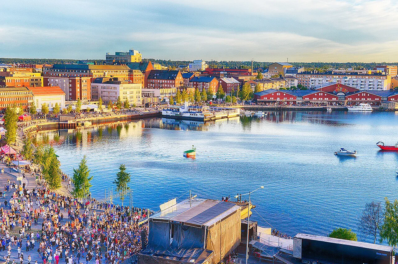
Luleå sits at the top of the Gulf of Bothnia in Norrbotten, close enough to the auroral oval that a modest disturbance in the solar wind can light the sky over the archipelago. Winter here is long, dark and cold, with sea ice forming along the coast and short daylight that leaves plenty of hours for watching. It suits travelers who want a real northern city as a base, with restaurants, museums and transport links, rather than a purpose-built resort.
The forecast is the easy part to get wrong. Many visitors watch the Kp number alone, ignore the cloud layer sitting over the coast, and spend a clear-sky night indoors or a cloudy one standing on a jetty. The method below treats cloud cover as the deciding factor and aurora activity as the second filter.
Why Luleå sits in a strong aurora belt
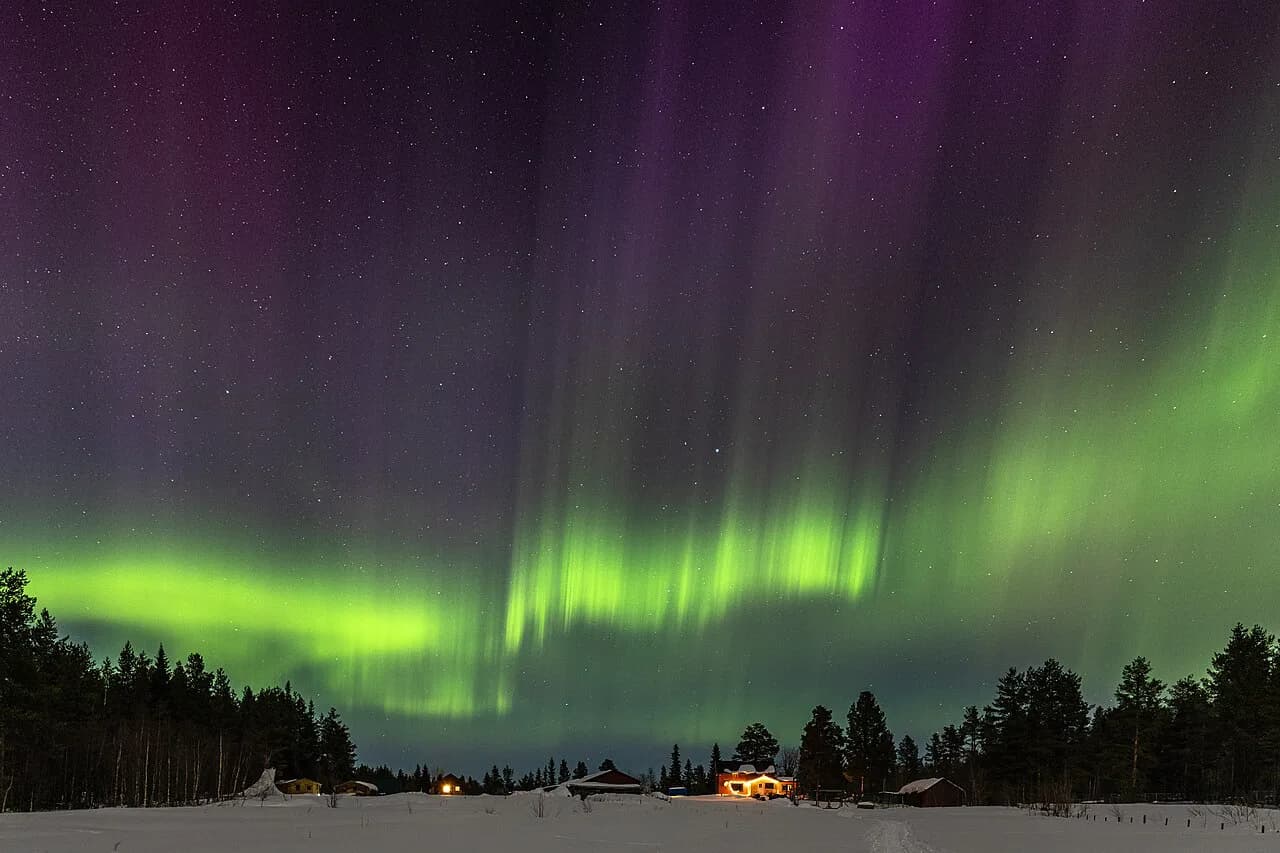
The aurora forms in a ring around the geomagnetic pole, and Luleå lies close enough to that ring that activity which barely registers in southern Sweden can be overhead here. You do not need a great geomagnetic storm; you need darkness, a clear patch of sky and enough solar wind to disturb the field. That combination is what makes the city a workable base rather than a compromise.
Coastal position cuts both ways. Open water and moving air bring cloud in off the gulf, sometimes in bands that break up quickly and sometimes in sheets that sit for days. Inland, toward the river valleys and forest, skies often clear sooner, which is why an evening decision may mean driving twenty or thirty minutes away from the coast rather than staying put.
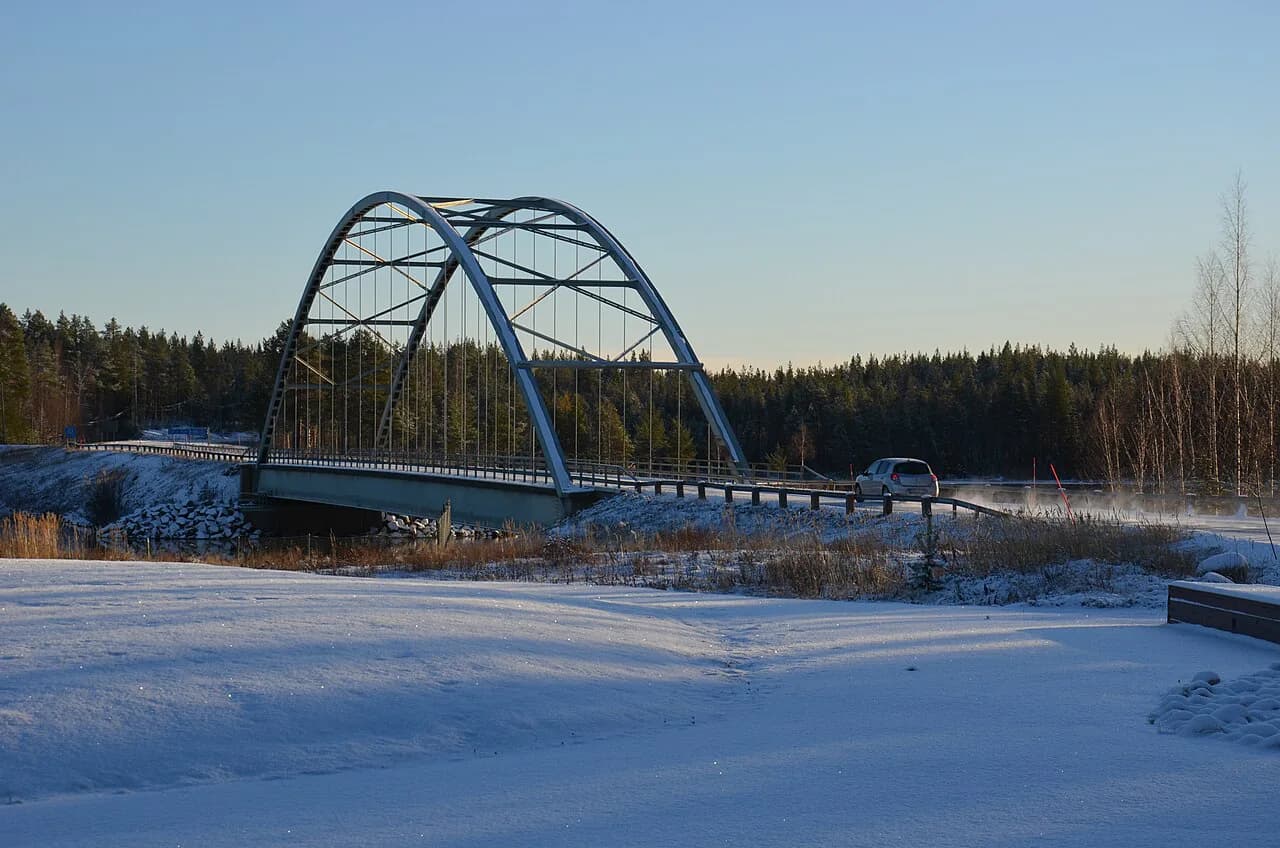
Light pollution matters less than you might expect. Central Luleå is bright enough to wash out faint arcs, but the shoreline and the bridges leading off the centre give quick access to darker water and sky. The city is compact, so the trade-off between comfort and dark sky is measured in minutes, not hours.
When the aurora season runs in Luleå
Dark nights around Luleå stretch from late August through early April, and the aurora can appear at any point in that window. Late-summer and September nights are mild and often clear, with the aurora low in the north before midnight. Deep winter brings the longest darkness but also the coldest and cloudiest weather.
A regional page covering the Scandinavian mountain villages notes that the aurora can be seen on clear late-summer nights as well as in winter, and that activity predicted at lower Kp values can still produce a visible display. Treat that as a reminder to watch the sky rather than the number. For Luleå, spring evenings in March and early April are often a good balance of clear skies and still-dark nights.
What the Kp index tells you at this latitude
Kp is a global measure of geomagnetic disturbance, running from 0 to 9, and it is a rough guide rather than a local prediction. In the Scandinavian mountains, a Kp of 4 or higher is generally described as good for a visible display, though the same page cautions that the actual outcome varies and that aurora can appear at lower values. Because Luleå lies at a similar magnetic latitude to those mountain villages, that threshold is a reasonable starting point here too.
What Kp does not tell you is where the auroral oval sits at any given moment, how far south it has expanded, or whether cloud will block it. A Kp 5 during a solid overcast is worthless; a Kp 2 with a clear northern horizon can be memorable. Use Kp to decide whether the coming nights are worth planning around, and use sky conditions to decide whether to go outside now.
Solar wind, Bz and timing: reading the short-term forecast
The short-term numbers that matter most are solar wind speed and Bz, the north-south orientation of the interplanetary magnetic field. A sustained negative Bz couples the solar wind to Earth's magnetic field and drives activity, while a positive Bz often means the aurora stays quiet even when Kp looks promising. Solar wind speed determines how quickly a disturbance arrives at Earth, so an inbound coronal hole stream can be forecast a day or two ahead but its exact timing is not.
This is why most services publish two horizons. A nowcast gives an estimated probability roughly 30 to 50 minutes ahead for a specific area, refreshed continuously from weather-station data, while a three-day outlook shows predicted Kp so you can see whether high activity is likely later in the evening or in the coming nights. Combining the two is more useful than either alone: the outlook helps you choose which nights to protect, and the nowcast tells you when to put your boots on.
Combining the aurora forecast with the cloud forecast
Cloud is the single most common reason a good aurora night produces nothing, and it is the variable you can actually plan around. Forecast sites for the Scandinavian mountains pair the aurora outlook with a weather forecast for the relevant valley so you can see whether the sky will be open. Read cloud cover hour by hour, not as a daily average; a night can go from eight oktas to clear in an hour as a front passes.
A more granular service shows how the pieces are combined. One forecast for Riksgränsen in Swedish Lapland scores each hour against requirements for aurora quality, solar elevation below minus eight degrees, aurora activity of at least 50 percent, total cloud cover of 30 percent or less, and visibility of at least 8,000 metres, and labels the hour a match only when every threshold is met. That is a useful model for your own thinking: a clear hour at astronomical twilight beats a heavily active hour under thick cloud.
The same breakdown identifies aurora quality, visibility and total cloud as the most frequent blockers across its forecast horizon, and it flags low visibility from fog or snow as a separate failure even when cloud cover is low. For Luleå, apply the same logic to sea fog and blowing snow over the ice: a clear forecast can still be spoiled by surface conditions near the water.
Local and regional forecast pages worth bookmarking
Start with a regional page that covers Swedish Lapland as a whole so you can see how activity and cloud vary between the coast and the mountains, then narrow to your own area for the night. The mountain-village forecast page bundles the 30-minute nowcast, the NOAA three-day Kp outlook and a cloud forecast based on yr.no data; its three-day section draws on NOAA, which also publishes the index directly.
Official weather services should be your second tab. SMHI covers Swedish cloud, wind and temperature, and its local forecasts are the basis for most aurora apps in the region. Recorded sighting logs, such as a reported aurora event near Luleå in late July, are interesting for context on how far south displays can reach, but they describe the past and tell you nothing about tonight.
If you are staying inland at Harads, an hour or so up the Lule River, the dark forest there is a different proposition from the coast, and pairing a stay at the Treehotel in Harads with a coastal night in town gives you two quite different sky conditions to work with.
Free alerts and how to time a night out
Alerts remove the guesswork of staying awake and watching a screen. Most aurora apps and forecast sites let you set a location and a threshold, sending a notification when predicted activity crosses it, and some add a cloud filter so you are only pinged when the sky is likely to be open. Set two levels: a moderate one that tells you to start paying attention, and a high one that means get dressed.
In practice, the most productive pattern near Luleå is to check the three-day outlook in the afternoon, confirm the cloud forecast holds through the evening, and then watch the nowcast after dark rather than committing to a single departure time. The strongest displays often come after local midnight, so a short sleep in the early evening is more effective than standing in the cold from dusk.
Where to watch near Luleå: coastline, islands and dark roads
The archipelago gives you choices that most inland bases cannot match. The ice road and the islands beyond it offer flat, unobstructed northern horizons once the sea ice is thick enough to walk or drive on, and the darkness over the ice is genuinely deep. Before setting out on the ice, follow the local operator guidance on marked routes and conditions rather than heading onto untested surface.
Closer in, the shoreline paths south of the centre and the quieter roads leading out of town toward the villages give quick access to dark sky without a long drive. A car is the single biggest practical advantage here: it lets you move twenty minutes inland if a cloud band stalls over the coast, and it gives you somewhere warm to wait between clear spells.
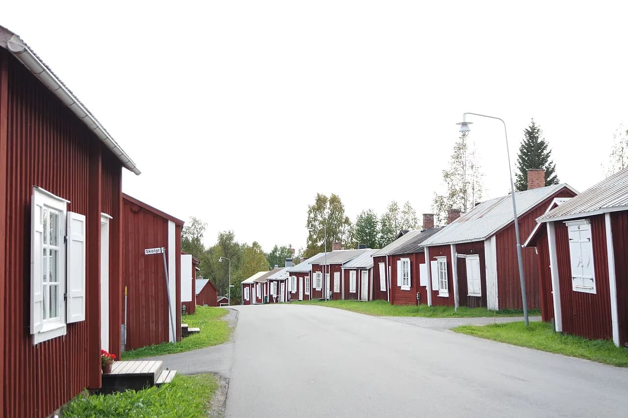
If you want a longer day out before an evening search, the gammelstad church town just outside Luleå pairs a historic wooden settlement with open ground and dark approach roads, and the Hägnan open-air museum on the same site is worth the detour in daylight.
Self-guided chasing versus a guided northern lights tour
Self-guided chasing from Luleå works well if you have a car, a driver willing to be out late, and a plan for where to head when the coast clouds over. The advantage is flexibility: you can abandon a spot after twenty minutes and try somewhere else, which guided groups rarely do. The disadvantage is that you own every decision about ice, road conditions and fuel on a cold night.
Guided tours remove those decisions. Operators typically collect you from your accommodation, drive to a spot chosen on the night, and lend thermal suits and boots when the source says so. In this region, most tours run in the evening and return after midnight, and many offer a second attempt if the first night is clouded out, so ask about that policy before booking. Group size matters more than distance when the aurora is faint, so check whether you are joining a small minibus or a full coach.
If your trip is partly about a memorable place to sleep, Arctic Bath in Harads offers a very different base from a city hotel, with the forest around it far darker than the coast. It suits travelers who want the accommodation to be part of the trip rather than a bed at the end of a long drive.
How many nights to allow
Treat nights as attempts. With changeable coastal cloud, a single night in Luleå gives you one roll of the dice, and two or three evenings gives you room to absorb a cloudy one without losing the trip. If the aurora is the main reason for coming, four or five nights across a week materially improves your odds of catching at least one clear, active window, though nothing can guarantee it.
Use the forecast to distribute those nights rather than spreading them evenly. If the three-day outlook shows a disturbance arriving on Thursday, keep Thursday evening free and spend the earlier nights on the city, the church town or a sauna instead of forcing a long drive on a quiet night. That way a modest trip is still a good trip even if the sky stays shut.
Beyond the forecast: where to stay and what else to do
A forecast plan only works if the rest of the trip holds up when the sky does not. Luleå Northern Lights covers the wider picture for this stretch of Norrbotten County, from the archipelago and the ice road to the dark forest bases inland, so you can line up daytime activities and accommodation around the same evening strategy.
If your dates fall in December, Christmas in Luleå is the period when the city fills with market stalls, decorated squares and short, blue daylight hours that leave long evenings for watching. It also means booking accommodation and any guided tour earlier than you would in February.
Plan Your Luleå Aurora Nights
Book your trip around the dark half of the year, build in more than one evening, and treat cloud as the first question and Kp as the second. A car, a modest drive out of town and a habit of checking the nowcast after dark will do more for your chances than any single forecast number.
Check SMHI for cloud and the accommodation or tour company directly for departure times and thermal suit policies before you commit. Then keep your evenings loose enough to move when the sky opens.
Frequently Asked Questions
How far in advance can the northern lights be predicted for Luleå?
Roughly a day or two for broad activity, and far less for the details that decide your evening. A three-day outlook shows predicted Kp so you can see whether a disturbance is likely in the coming nights, while a short-term nowcast gives an estimated probability about half an hour ahead for a specific area. Neither tells you whether cloud will clear over the coast, so treat the outlook as a way to pick which nights to protect and the nowcast as the cue to go outside.
Is a high Kp index enough to see the aurora in Luleå?
No. Kp describes global geomagnetic disturbance, not the sky above your head. In the Scandinavian mountains a Kp of 4 or higher is generally described as good for a visible display, and aurora can still appear at lower values, but thick coastal cloud will hide anything. A clear northern horizon at modest activity usually beats a strong disturbance under overcast.
Which months are best for northern lights in Luleå?
Dark nights run from late August through early April, and the aurora can appear at any point in that window. Late-summer and September evenings are mild and often clear, with displays low in the north before midnight, while deep winter brings the longest darkness along with the coldest and cloudiest weather. March and early April are often a good balance of clearing skies and still-dark nights.
What time of night gives the best chance?
There is no fixed hour that guarantees a display, but activity often builds after local midnight, so a short sleep in the early evening is more useful than standing in the cold from dusk. Watch the nowcast after dark rather than committing to a single departure time, and keep an eye on the northern horizon where faint arcs first appear.
Do I need to leave Luleå to see the northern lights?
Not necessarily. The shoreline and the bridges out of the centre reach darker sky within minutes, and the archipelago gives flat, unobstructed northern horizons once the sea ice is safe to cross. A car helps most: it lets you move twenty minutes inland when a cloud band stalls over the coast, and gives you somewhere warm to wait between clear spells.
Sources
Notes for your Arctic winter trip
Optional updates to our northern lights guides.
You might also like
Continue reading
More guides you'll find useful